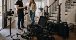
A drone can reveal the one thing still photos keep hiding, or it can spend twenty seconds admiring a roof. The difference is the brief. Before anyone launches, decide what a buyer needs to understand about the land, approach, view, access, or relationship between buildings. If the answer is nothing, keep the drone in its case.
I have planned and reviewed aerial footage across residential, commercial, and large institutional properties. The useful shots were never useful because they were high. They were useful because they explained access, land, scale, a view, or the relationship between buildings. That is the standard I use here.
Who this is for: listing agents, photographers, and marketing coordinators deciding whether aerial footage will clarify a property's value.
Research note: Researched from current FAA operating guidance and real-estate video practice sources. This is an operational guide, not legal advice; the pilot remains responsible for each flight.
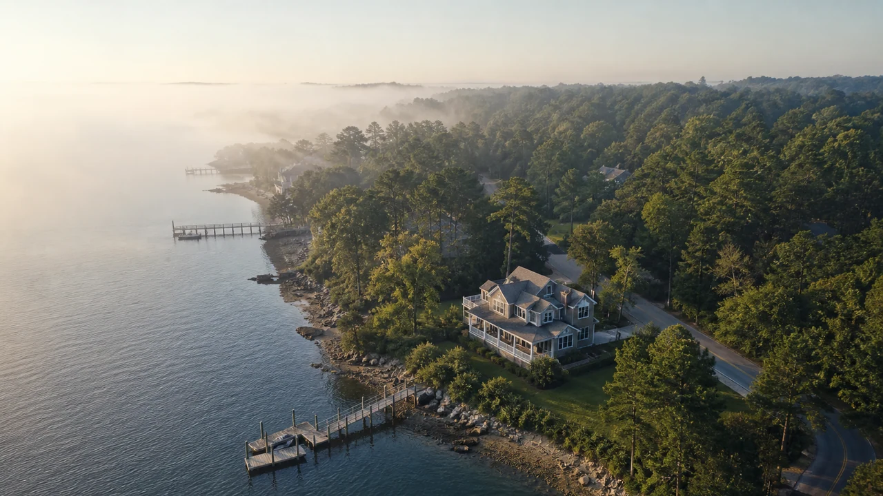
Does This Property Actually Need a Drone?
Before you ask for a drone add-on, write the sentence the aerial needs to prove. If that sentence is basically ‘the house has a roof,’ you can save the money.
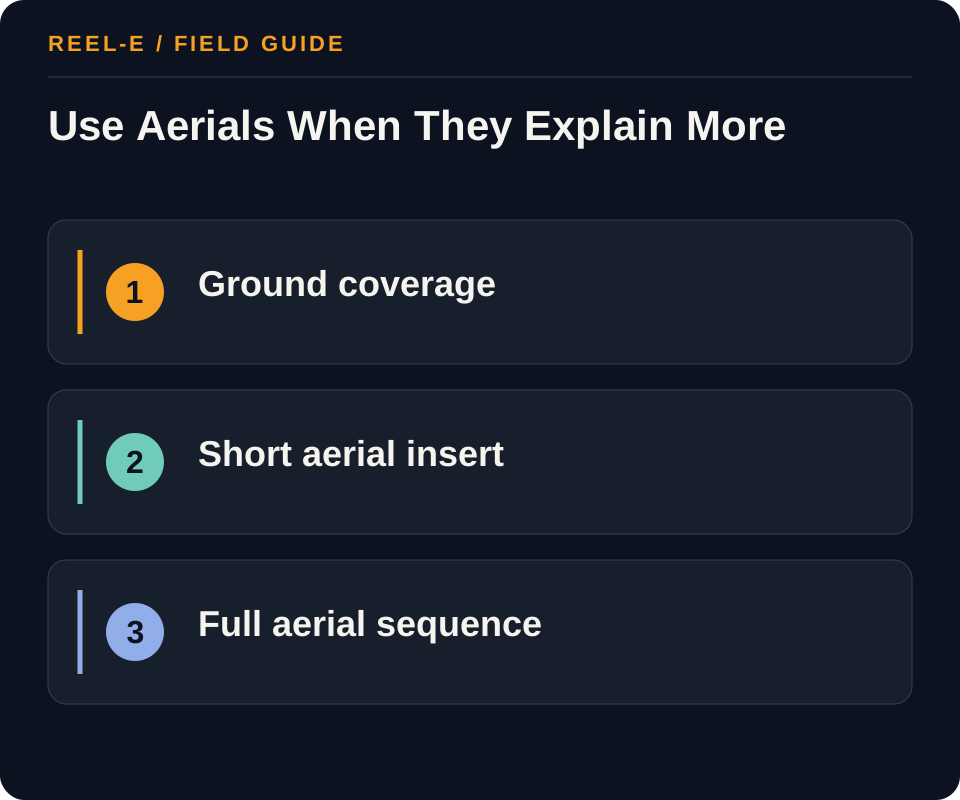
| Path | Use It When | Reconsider It When |
|---|---|---|
| No Drone | The lot and surroundings are ordinary and interior condition drives the decision. | Acreage, water, access, views, outbuildings, or proximity are essential. |
| Short Aerial Insert | Two or three context shots will establish the property and neighborhood. | The asset needs a detailed campus, land, or approach story. |
| Full Aerial Sequence | Land, commercial access, development context, or a large estate is central. | The edit would repeat the same roofline without adding information. |
No Drone
- Best Fit: The lot and surroundings are ordinary and interior condition drives the decision.
- Pause If: Acreage, water, access, views, outbuildings, or proximity are essential.
- Review: Share of aerial claims immediately supported by a ground image, map, or label. Add a match cut or remove the unsupported aerial.
- Control: Unsafe or Noncompliant Flight. Use a qualified operator and let the pilot control airspace, weather, and safety decisions.
Short Aerial Insert
- Best Fit: Two or three context shots will establish the property and neighborhood.
- Pause If: The asset needs a detailed campus, land, or approach story.
- Review: Unique decision-relevant aerial shots divided by all aerial shots. Trim repeated orbits and roof passes.
- Control: Implied Boundaries or Amenities. Use verified maps/labels and avoid camera framing that overstates what is included.
Full Aerial Sequence
- Best Fit: Land, commercial access, development context, or a large estate is central.
- Pause If: The edit would repeat the same roofline without adding information.
- Review: Viewers reaching the final quarter of the listing video by channel. Shorten the aerial opening if early exits rise.
- Control: Privacy Complaints. Plan camera direction, altitude, and edit review to minimize unnecessary capture of neighbors and people.
What Years of Aerial Reviews Have Taught Me
Altitude Is a Point of View, Not a Strategy
A low approach can explain the arrival sequence. A higher frame can show lot position or proximity. Neither needs a heroic orbit unless the orbit reveals something the buyer could not understand from the ground.
The Ground Shot Finishes the Thought
If the drone shows a path to the water, the next shot should help the viewer recognize that path at eye level. Good aerial editing creates orientation. Bad aerial editing creates a very elegant geography quiz.
The Pilot Owns the Flight Decision
A producer can explain the marketing need, but the remote pilot decides whether the flight is safe and allowed. Build weather and airspace uncertainty into the schedule instead of turning a legal and safety decision into a client-service argument.
Three Shots That Usually Earn Their Place
The Arrival Shot
Use a controlled approach when the road, gate, drive, frontage, or relationship to the neighborhood helps explain the property. The frame should make orientation easier and should connect to the ground-level arrival in the edit. Avoid flying simply because the front elevation looks dramatic from twenty feet. The buyer should learn how the property is reached, not experience the aerial equivalent of a very long doorbell.
The Relationship Shot
A higher view can show the main building, accessory structure, usable land, shared amenity, water, road, or surrounding context together. Verify any boundaries or labels separately and avoid camera angles that imply ownership or access the facts do not support. When the relationship is important, hold the frame long enough to understand it and then cut to the ground detail that completes the explanation.
The Edit Review I Do With the Sound Off
Can I Explain Every Aerial Without the Music?
Mute the track and name what each shot adds: access, acreage, orientation, view, relationship, or transition. Remove footage that only repeats the same roof and lawn from a slightly more enthusiastic angle. Then check that labels, implied boundaries, neighboring property, vehicles, and people remain accurate and appropriate. Music is excellent at making repetition feel important. The silent review gives the property one last chance to disagree.
A Simple Approval Question
Would the Buyer Miss This Fact Without the Aerial?
If yes, keep the shot and make the relationship clear. If no, ask whether it improves orientation or pacing enough to justify its time. This one question protects the edit from becoming a drone reel that happens to contain a property.
Plan the Flight Around Buyer Questions
Decide Whether the Property Earns an Aerial Sequence
Start with the buyer question, not the availability of a drone. Acreage, water, topography, a private approach, multiple structures, commercial circulation, nearby amenities, and view corridors can justify an aerial. An ordinary subdivision roofline usually cannot. Write the fact the aerial must establish, the ground-level proof that supports it, and the shot that would be misleading. This gate protects budget and prevents a cinematic opening from delaying the rooms or features that drive the decision.
Complete a yes-or-no aerial-value gate before requesting a quote.
Brief the Remote Pilot Without Directing the Flight
The marketing team supplies the address, access, decision goals, known obstacles, privacy concerns, and reference images. The remote pilot owns the legal and safety decision, including airspace, weather, people, traffic, launch location, and whether a requested maneuver is acceptable. Ask who obtains authorization, what happens when conditions change, how insurance is documented, and how footage is licensed and retained.
Use one written handoff for access, goals, constraints, authorization, and rescheduling.
Build an Air-To-Ground Evidence Map
Organize the edit as paired evidence: approach to entrance, high orientation to verified map, amenity reveal to ground detail, outbuilding relationship to interior, and closing context to the final action. Avoid repeated roof passes and unlabeled views that imply ownership outside the parcel. If boundaries matter, use an approved map or survey-derived overlay and state when a graphic is illustrative.
Pair every aerial claim with a ground view, map, label, or verified caption.
From Address to Approved Aerial Edit
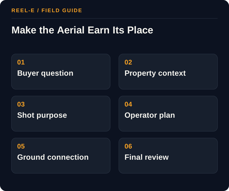
This is the sequence I would want on a real brief. It keeps the buyer question, pilot responsibility, capture plan, and edit connected from the start.
1. Write the Buyer Question First
Name what the aerial must prove: lot boundaries, a water view, a private approach, walkability, roof condition, parking flow, or the relationship between structures. If the team cannot finish the sentence ‘the viewer needs to see…,’ the drone is probably a decorative expense.
- Record: Buyer Question in the Aerial Value Gate
- Control: Use a qualified operator and let the pilot control airspace, weather, and safety decisions.
- Review: Share of aerial claims immediately supported by a ground image, map, or label. Add a match cut or remove the unsupported aerial.
2. Select the Operator and Rights
Ask who will operate the aircraft, whether the work is conducted under the applicable commercial rules, who obtains airspace authorization when required, what insurance is carried, and whether the delivered license covers MLS, paid ads, social, websites, and future portfolio use.
- Record: Decision Shots in the Remote-Pilot Brief
- Control: Use verified maps/labels and avoid camera framing that overstates what is included.
- Review: Unique decision-relevant aerial shots divided by all aerial shots. Trim repeated orbits and roof passes.
3. Run a Preflight Location Check
Provide the exact address, proposed time, property contact, takeoff area, known obstacles, neighboring privacy concerns, and any events or construction. The operator,not the agent,makes the final safety and legality decision, including whether conditions require rescheduling.
- Record: Verified Fact in the Aerial Value Gate
- Control: Plan camera direction, altitude, and edit review to minimize unnecessary capture of neighbors and people.
- Review: Viewers reaching the final quarter of the listing video by channel. Shorten the aerial opening if early exits rise.
4. Build a Decision-Led Shot List
Prioritize an establishing approach, one orientation reveal, the key feature, an access or amenity shot, and an exit. Specify what should not be shown. Avoid demanding risky maneuvers or a fixed shot when the pilot identifies a safer alternative.
- Record: Authorization Owner in the Remote-Pilot Brief
- Control: Tie every requested shot to a buyer question before filming.
- Review: Share of aerial claims immediately supported by a ground image, map, or label. Add a match cut or remove the unsupported aerial.
5. Connect Air and Ground
Match aerial clips to interior or ground photographs so the viewer understands why the context matters. A view reveal should lead to the room with that view; an amenity approach should lead to the amenity; an acreage shot should be paired with an accurate boundary explanation if one is available.
- Record: Cheaper Alternative in the Aerial Value Gate
- Control: Use a qualified operator and let the pilot control airspace, weather, and safety decisions.
- Review: Unique decision-relevant aerial shots divided by all aerial shots. Trim repeated orbits and roof passes.
6. Review for Truth and Pacing
Check that labels, boundaries, distances, and visual implications are supportable. Remove redundant passes, abrupt speed changes, privacy intrusions, and shots that make the property appear to include land or features outside the listing.
- Record: Delivery Rights in the Remote-Pilot Brief
- Control: Use verified maps/labels and avoid camera framing that overstates what is included.
- Review: Viewers reaching the final quarter of the listing video by channel. Shorten the aerial opening if early exits rise.
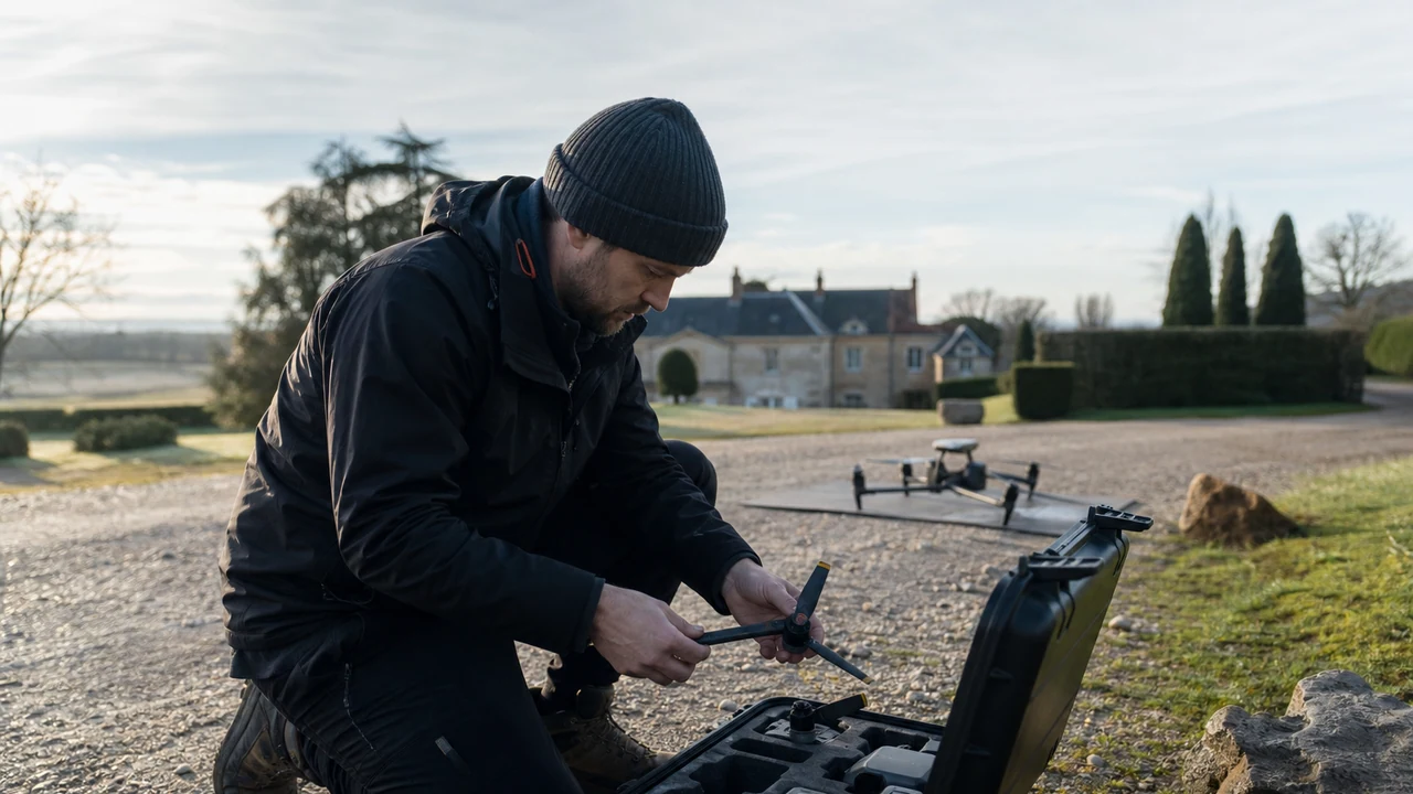
A Worked Example: Five-Acre Listing with a Detached Studio
The situation: The still-photo set shows a strong house and studio but does not explain their separation, driveway access, or tree buffer from the road.
The approach: The brief requests an approach, a high orientation shot, a lateral move showing house-to-studio distance, a rear view of usable land, and a closing pull-away. The edit cuts each aerial to the matching ground photo rather than running them as a separate montage.
The result to review: The finished video communicates the spatial story in under thirty seconds of aerial footage. Success is judged by clarity and completion rate, not by the number of drone clips delivered.
Notice that the aerial is not the whole video in this example. It establishes the property, then gets out of the way. That restraint is usually what makes it feel expensive.
Measure Clarity, Not Flight Time
I would review whether each aerial shot adds information and whether viewers stay with the transition back to ground footage. Flight time and clip count mostly tell you how long the drone was busy.
| Metric | Definition | How to Use It |
|---|---|---|
| Aerial-To-Ground Continuity | Share of aerial claims immediately supported by a ground image, map, or label. | Add a match cut or remove the unsupported aerial. |
| Meaningful Shot Ratio | Unique decision-relevant aerial shots divided by all aerial shots. | Trim repeated orbits and roof passes. |
| Video Completion | Viewers reaching the final quarter of the listing video by channel. | Shorten the aerial opening if early exits rise. |
Tools You Can Use
Aerial Value Gate
Decide whether drone footage adds decision value.
- Buyer Question: Current fact, source, owner, approval date, effect on write the buyer question first, and fit with no drone.
- Feature Impossible from Ground: Current fact, source, owner, approval date, effect on select the operator and rights, and fit with short aerial insert.
- Verified Fact: Current fact, source, owner, approval date, effect on run a preflight location check, and fit with full aerial sequence.
- Privacy or Boundary Risk: Current fact, source, owner, approval date, effect on build a decision-led shot list, and fit with no drone.
- Cheaper Alternative: Current fact, source, owner, approval date, effect on connect air and ground, and fit with short aerial insert.
- Go or No-Go Owner: Current fact, source, owner, approval date, effect on review for truth and pacing, and fit with full aerial sequence.
Remote-Pilot Brief
Transfer marketing context without overriding pilot authority.
- Address and Access: Current fact, source, owner, approval date, effect on select the operator and rights, and fit with short aerial insert.
- Decision Shots: Current fact, source, owner, approval date, effect on run a preflight location check, and fit with full aerial sequence.
- Known Obstacles: Current fact, source, owner, approval date, effect on build a decision-led shot list, and fit with no drone.
- Authorization Owner: Current fact, source, owner, approval date, effect on connect air and ground, and fit with short aerial insert.
- Weather Rule: Current fact, source, owner, approval date, effect on review for truth and pacing, and fit with full aerial sequence.
- Delivery Rights: Current fact, source, owner, approval date, effect on write the buyer question first, and fit with no drone.
Where This Usually Breaks
Aerial mistakes are unusually good at becoming public. Check the flight, the implied boundaries, nearby people, and the edit before the dramatic music makes everything feel more certain than it is.
| Risk | Practical Control |
|---|---|
| Unsafe or Noncompliant Flight | Use a qualified operator and let the pilot control airspace, weather, and safety decisions. |
| Implied Boundaries or Amenities | Use verified maps/labels and avoid camera framing that overstates what is included. |
| Privacy Complaints | Plan camera direction, altitude, and edit review to minimize unnecessary capture of neighbors and people. |
| Beautiful But Unhelpful Footage | Tie every requested shot to a buyer question before filming. |
Unsafe or Noncompliant Flight
- Control: Use a qualified operator and let the pilot control airspace, weather, and safety decisions.
- Review Stage: Write the Buyer Question First
- Early Warning: Share of aerial claims immediately supported by a ground image, map, or label.
- Response: Add a match cut or remove the unsupported aerial.
Implied Boundaries or Amenities
- Control: Use verified maps/labels and avoid camera framing that overstates what is included.
- Review Stage: Select the Operator and Rights
- Early Warning: Unique decision-relevant aerial shots divided by all aerial shots.
- Response: Trim repeated orbits and roof passes.
Privacy Complaints
- Control: Plan camera direction, altitude, and edit review to minimize unnecessary capture of neighbors and people.
- Review Stage: Run a Preflight Location Check
- Early Warning: Viewers reaching the final quarter of the listing video by channel.
- Response: Shorten the aerial opening if early exits rise.
Beautiful But Unhelpful Footage
- Control: Tie every requested shot to a buyer question before filming.
- Review Stage: Build a Decision-Led Shot List
- Early Warning: Share of aerial claims immediately supported by a ground image, map, or label.
- Response: Add a match cut or remove the unsupported aerial.
Verify current primary guidance for the actual jurisdiction, platform, campaign, property, and professional relationship. This researched guide is not individualized legal, aviation, financial, privacy, or compliance advice.
My Bottom Line
Use a drone when the property has an aerial story. Brief that story in plain language, let the pilot own the flight, and keep only the shots that make the asset easier to understand. The rest is very pretty B-roll.
Sources and Research Notes
Open the source ledger- FAA guidance for commercial small-drone operations. Primary source for Part 107 and controlled-airspace context; verify current local requirements before a flight. Accessed August 12, 2026.
- NAR video marketing practice article. Industry practice source for concise, audience-centered real-estate video planning. Accessed August 12, 2026.
- FAA B4UFLY and airspace resources. Primary federal situational-awareness resource; it does not replace authorization or pilot judgment. Accessed August 12, 2026.
- Adobe media accessibility resources. Primary product guidance supporting caption and accessible-delivery planning. Accessed August 12, 2026.
- Matterport drone guide. Format and coverage reference. Explains benefits and shot ideas but leaves operator handoff, rights, truthful boundaries, and air-to-ground edit logic thin. Accessed August 12, 2026.
- Zillow drone guide. Format and coverage reference. Useful agent overview and equipment context, not a complete preflight, licensing, and review system. Accessed August 12, 2026.
- FAA commercial operators. Format and coverage reference. Primary rule source rather than an editorial competitor; it anchors the compliance sections ranking articles often summarize loosely. Accessed August 12, 2026.
Sources support only the claims described in their notes. Reopen current primary sources before a purchase, launch, or compliance decision.